skip to main |
skip to sidebar
Color My World - Capitol Reef Back Country
Roger here... Warning.... This post is longer than usual and has more pictures. It reflects one of the best travel days we have ever encountered.
Remember finger-painting when you were in kindergarten? I can remember my dear teacher, Mrs. Daugherty, telling us that we could use any colors as long as we were happy with the result. Well, I must say that the higher power had a heyday with colors when the Capitol Reef area of Utah was created. He/She had to be happy with the result.
One of our best adventures started when we decided to rent a four-wheel-drive Jeep that was available at our campground, so that we could explore some of the back (dirt) roads both inside and outside the national park. The Jeep rental certainly was not in our budget; however, our Toyota Matrix was not up to this particular task. Why travel all the way to this remote part of Utah and not see some of the best sights? So off we went. By the way.... I really liked driving the Jeep.
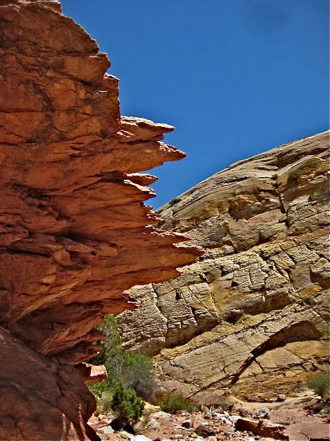
As those who know me can tell you, I like to categorize events that could be confusing. So, I will be describing our 135 mile-day in the four parts of the rectangle that we traveled. Our first leg took us out of Torrey and through the main (mostly visited) section of Capitol Reef National Park on Highway 24. We have already traversed this route multiple times, but I am including a picture of one of the familiar formations in that part of the park.
The second (and longest in terms of time) leg of the trip began when we turned south onto Notom-Bullfrog Road, just outside of the national park's eastern boundary. The road was paved at this point and offered nothing unusual. The town of Notom seemed to be nothing more than a few plaques along the roadside, including one of the "Notom Town Song." I sang an enthusiastic version of the song to Dianne, and received a less than enthusiastic response.
Dianne took a picture of some cool hoodoos across from what was at one time, evidently, Notom. Nice hoodoos, but nothing unusual for this area.
The road soon turned to dirt. Yea! So much fun driving the Jeep on a bumpy, twisty dirt road. (It really was fun.)
Uh Oh! Road construction! Out here in the middle of nowhere! Road construction! You have got to be kidding! One of the road workers (a nice man, by the way) walked up to the Jeep asking me to give him ten minutes or so to make the road passable so I could get through. Good deal. It would have been a shame to have to turn back.
After about 15 minutes, he signaled me to proceed. OK, then. I went down into the depression, in four-wheel-drive, and plowed into the loose dirt/sand. The Jeep shimmied a little bit but made it through. I hit the gas so I could make it up the other side, waved at the workman, and moved forward with the realization that Dianne and I would pretty much be on our own out here. We brought plenty of water and food.
The scenery soon improved. We both loved the red and white striping of the cliffside on this formation - only a hint of the colors to come.
The roadway soon got a little more interesting, but nothing that me and my Jeep couldn't handle. We re-entered the national park.
One of the prominent geological features of this part of the drive was the dramatic uplifting of the rock. It looked as if something squeezed the land so hard that large sections just buckled and slid upward and over the adjacent rock. (As a former science teacher, I can tell you, that is what happened). Notice the different colors on the uplifted layers.
Here are a couple of closer shots. We soon will be hiking into those upheavals.
We intended to do a hike in the backcountry. We had three options, but time would permit only one. They are probably all great, but Dianne picked a winner --- the six-mile Red Canyon Trail. I turned the Jeep into a camping area to find the trail head. I was surprised to see that the campground was full of tents, despite the fact that we had not seen another human being (other than the road workers) since we turned off Highway 24. The second surprise was that NO ONE was in the campground --- lots of tents, a couple cars, no people. A mystery. Oh well, we parked the Jeep, grabbed a bunch of water and hit the trail.
The first part of the trail was nice, but nothing special. There was a lot of slickrock, scrub growth, and sand, sand, sand. Mostly red sand.
The trail description said that we would drop into a white-sand wash that would take us into the canyon, but it seemed as if we would never get to that point. Because it was going to be a long day, we almost turned back. Glad we didn't.
Eventually, we did drop into the wash. Look at all the beautiful things we found. In this shot you can see pink, white, and bright yellow.
The rock below is amazing.... orange, ochre, tan, white, pink, and purple --- outlined with green shrubs and an azure sky.
The walk along the wash changed at every turn. We were seeing rocks and colors like we had never seen before.
Much of the slickrock along the way had a multi-colored, polished finish.
The vistas never ceased to amaze.
OMG! A T-rex head right by the trailside :-)! I wonder what other fossils we'll find along this trail?
Well, that is definitely petrified wood. That specimen would bring a lot of $ in a rock store.
Look what Dianne found! A dinosaur bone! Actually, this may very well be a dinosaur bone. It has three surfaces that at different angles contain inner circular features of a different composition. Could the circles have been bone marrow? Could the bone have been a vertebrae or a bone joint? Fun to speculate. We left the specimen on a large boulder for others to discover.
No hike with Dianne would be complete without a flower picture. These blooms were on a small tree.
More colorful formations... blue skies, green plants, red and gold rock. The picture below is the same formation from a different angle.
When we reached the impenetrable wall of red rock, it was time to retrace our steps.
On our return to the car, we saw the expansive water-pocket fold in the distance. The closer look below illustrates the green, gold, and purple colors in the formation.
We retrieved the Jeep and we were soon back on the dirt road. We were heading closer to the water pocket fold. We could not believe the colors in this feature.
Soon the ever-changing colors presented themselves in the dirt road. It makes sense. In Indiana, the dirt roads are brownish-gray. In Georgia they are red. In this part of Utah, they are gold, yellow, red, green and purple --- just like the surroundings.
After a long, but wonderful drive, we finally reached the turning point that took us on the third leg of our journey. We headed west on Burr Trail Road, on our way out of the national park and to the small town of Boulder.
Dianne immediately noticed the vertical red, white and green stripes on the cliffside in front of us and thought they looked like a (color-reversed) Mexican flag.
Look up ahead. Are those switchbacks? If so, are they going to take us all the way to the top?
Yup.
Truth be told, we knew the switchbacks were coming, and the Jeep performed admirably. We were hoping to have a late picnic lunch in the picnic area that we knew was at the top. Imagine our amazement when we found eight vans parked in the picnic area and two people sitting at the only table. We had not seen another living being since the road construction, and here was a convention.
We decided to park the Jeep and eat lunch anyway. A man sitting at the picnic table saw us and invited us to sit in the shade at the end of the table. As we talked, two mysteries were solved. The friendly man was a geology professor at Southern Utah University. All the young people were his students who were doing a field study. They were the people from the abandoned tent village at the Red Canyon Trailhead. (The picture above shows the view we had from the picnic table.)
After talking for a while, Dianne went to the car to get our camera. She wanted the professor to look at the pictures of what we thought could be a dinosaur bone. He said that it is likely that it is the fossil of a dinosaur bone. He said that the wash where we found the fossil is in the same geological formation as that of Dinosaur National Monument. He said that the pictures, along with our description of the weight of the rock, lead him to believe that we did discover a dinosaur bone. VERY COOL.
After lunch, we exited the national park and welcomed the return of pavement. However the magnificent scenery remained, including the opening photo of this blog --- look at it again. So many colors. The picture above proves that rocks really do fall in falling rock zones.
A few more amazing views before we reach Boulder.
We began the fourth and final leg of our adventure when we turned north on Scenic Byway 12 in the tiny town of Boulder. The scenery was very different on this leg of the trip as we climbed Boulder Mountain in the Dixie National Forest to an altitude of 9600 feet. We left the desert environment and entered the land of forests.
The expansive aspen forests with their white bark were so different than all the colored rock formations we had seen, but just as beautiful in their own way. Dianne took a picture of me camouflaged in the woods with my green shirt.
(Dianne here: I just have to insert one of my favorite photos of Roger taken in this same spot 14 years ago :)
Before descending the other side of the mountain, we took a couple shots of the amazing vistas showing a far-away view of the places we had been. If you could ignore all the green trees in the foreground, the picture below looks a lot like the Grand Canyon.
The mountain lake below looks so inviting.
135 miles..... and we are back at our motor home. It was a full day.
I don't have a pet picture of the day this time, but I do have a Bovine tale. On our way across Boulder Mountain I became irritated with the driver of the car in front of me. He was going so slow. I don't mind people viewing the scenery, but he was hitting the brakes and going around ten miles per hour. Oh wait, is that a cow in the road? Never mind. I knew that we were in an open-range area, but I did not expect to see a cow on top of a mountain at 9600 feet.
The next few miles continued to be slow as we encountered other members of the herd.
Bessie seemed a little irritated that we disturbed her dinner. Look at her eyes.
Big Red seemed a little more forgiving.
Black Bart wasn't the least bit concerned.


4 comments:
Great post, super photos, and loved that you found a huge fossil.
soooo soooo much fun to see it again. I found Red Canyon in the mid 90's, one of my favorite hikes. A lifetime friend and I took her fifth wheel on the no tom road to that campground and I managed to back it into that far campsite. She never forgave me for that. :) I think every single one of her window shades came loose on those washboards...the worst ever. I lost that friend to breast cancer, but Red Canyon is ours. thanks for the memories. Capitol Reef is the center of the world as far as I am concerned. My most favorite place ever. Now you need to get up to Cathedral Valley and Ten Thousand Lakes mountain for a completely different picture. don't take the big rig! :)
Sooooo glad you did that loop! And what a find you had with the dinosaur bone - truly an experience you will always remember.
What a great trip and fabulous post!! The organization of the post was superb;o))
Absolutely a day to remember!!!!
Post a Comment